
Commercial satellite constellations reshape strategic surprise across battlefields

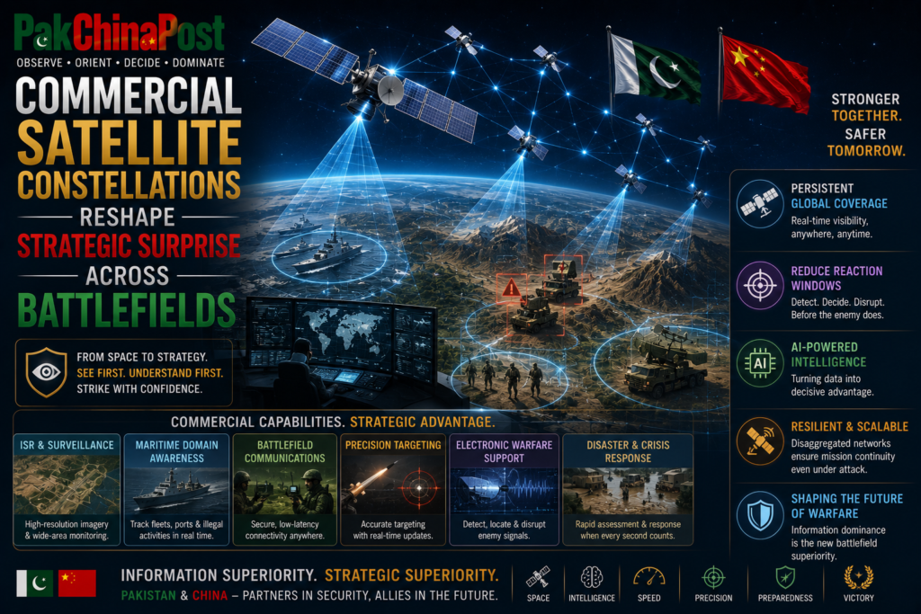
Pak China security planners increasingly confront a strategic environment in which the traditional distinction between classified intelligence and publicly observable military activity is steadily eroding. Commercial satellite constellations, privately operated synthetic aperture radar platforms, hyperspectral imaging systems, radio frequency detection satellites and an expanding ecosystem of open source intelligence communities have fundamentally altered the mechanics of strategic observation. Military deployments that once remained concealed through geographical remoteness, restrictive airspace or conventional camouflage are now repeatedly captured, analysed and disseminated by commercial entities operating entirely outside governmental command structures. The resulting transparency has transformed battlefield preparation, strategic signalling and crisis stability into matters extending well beyond military capabilities alone. Defence establishments in Islamabad and Beijing therefore face an increasingly complex requirement. They must preserve operational ambiguity without assuming that physical concealment alone can protect sensitive activities from continuous commercial observation.
Recent conflicts have demonstrated that strategic surprise has become considerably more difficult to sustain. Commercial imagery has documented troop concentrations, missile deployments, naval movements, logistics facilities, airfield construction and infrastructure expansion long before official governments acknowledged their existence. Independent analysts, academic institutions, technology firms and volunteer intelligence communities increasingly process vast quantities of satellite data using artificial intelligence capable of identifying subtle infrastructure modifications that human analysts might overlook. This evolution has diminished governmental monopolies over strategic intelligence while simultaneously accelerating the public circulation of military assessments during periods of heightened tension. Information that once travelled through classified diplomatic channels now frequently reaches international audiences within hours, influencing financial markets, diplomatic calculations and military perceptions before official statements emerge.
For Pakistan and China, this changing intelligence landscape presents opportunities alongside profound vulnerabilities. Both countries have invested substantially in space capabilities, digital infrastructure and geospatial technologies, yet both remain exposed to persistent observation conducted by foreign commercial providers operating beyond national jurisdiction. Satellite constellations owned by multinational corporations now revisit strategically significant locations multiple times daily, producing imagery with growing spatial precision and temporal frequency. Synthetic aperture radar systems further eliminate the protective advantages historically offered by darkness, cloud cover or adverse weather. Consequently, military planners cannot presume that environmental conditions will shield operational preparations from external observation.
The implications extend well beyond tactical deployments. Strategic infrastructure including missile storage facilities, logistics hubs, transportation corridors, naval construction yards, aircraft shelters, command installations, fibre optic communication networks and dual use industrial complexes increasingly attract continuous commercial scrutiny. Infrastructure expansion intended for long term deterrence or national resilience rapidly becomes subject to international interpretation. Commercial satellite imagery frequently serves as the evidentiary foundation for geopolitical narratives promoted by governments, think tanks, media organisations and financial analysts. Once imagery enters the public domain, states often lose the ability to shape its initial interpretation, regardless of subsequent official explanations.
Open source intelligence has consequently matured into a strategic instrument rather than merely an academic or journalistic enterprise. Collaborative analytical communities now integrate satellite imagery with maritime automatic identification system transmissions, aircraft transponder signals, social media content, procurement databases, geolocation techniques, meteorological information and artificial intelligence driven pattern recognition. This multidimensional analytical process generates remarkably detailed assessments regarding military readiness, industrial mobilisation and logistics activity. Governments therefore confront an information ecosystem where secrecy is no longer undermined solely by espionage but by the cumulative analytical capacity of globally distributed civilian networks.
Pakistan China defence cooperation should therefore recognise that operational security increasingly depends upon managing observable signatures rather than merely restricting classified information. Military doctrine developed during previous decades frequently assumed that denying adversaries direct physical access could adequately preserve operational secrecy. Contemporary reality demands a broader understanding. Observable infrastructure expansion, transportation rhythms, procurement activity, electromagnetic emissions, construction patterns, commercial shipping behaviour and workforce movements collectively generate identifiable signatures capable of revealing strategic intentions despite the absence of traditional intelligence collection.
Strategic communications acquire heightened significance within this environment. Commercial imagery often creates interpretative vacuums before governments formulate coherent public narratives. During periods of military tension, incomplete imagery may generate speculative reporting capable of influencing diplomatic reactions or financial behaviour. Delayed governmental responses risk allowing external narratives to become entrenched before official clarification emerges. Consequently, defence communication strategies should evolve from reactive public affairs functions into integrated components of national security planning. Strategic messaging must anticipate commercial observation rather than merely respond after imagery becomes internationally disseminated.
Crisis management likewise enters an unprecedented phase. Historical military crises frequently unfolded within environments characterised by incomplete information and restricted public visibility. Contemporary crises increasingly occur under continuous observation by commercial satellites capable of documenting military movements almost in real time. While enhanced transparency may reduce certain risks associated with accidental escalation by revealing defensive rather than offensive activities, it simultaneously creates pressures for rapid political interpretation. Governments may feel compelled to respond publicly before comprehensive intelligence assessments become available, thereby increasing decision making volatility during already sensitive situations.
The accelerating commercialisation of space also complicates traditional deterrence theory. Deterrence historically relied partly upon uncertainty regarding force disposition, reserve mobilisation and operational readiness. Persistent commercial surveillance reduces portions of that uncertainty. Adversaries may obtain clearer estimates regarding equipment concentrations, logistics preparation or infrastructure utilisation through publicly accessible imagery rather than exclusively through classified intelligence assets. Although commercial observations rarely provide complete strategic understanding, they nevertheless narrow informational asymmetries that previously supported deterrence ambiguity.
Pakistan China strategic planners should therefore distinguish between concealment and uncertainty. Absolute concealment may become increasingly unattainable, whereas carefully designed uncertainty regarding operational intent, force employment, deployment timing and decision thresholds remains achievable. Military doctrine should consequently emphasise deception through behavioural complexity rather than dependence upon physical invisibility alone. Sophisticated deception architectures integrating decoy infrastructure, multispectral camouflage, electromagnetic signature management, inflatable equipment, artificial thermal emissions and controlled logistics patterns may preserve operational ambiguity despite persistent observation.
Artificial intelligence further transforms commercial observation into predictive intelligence. Machine learning systems increasingly analyse historical imagery sequences to identify abnormal activity preceding military operations. Construction acceleration, unusual transportation density, temporary storage facilities, changes in aircraft dispersal or modifications to naval maintenance schedules may collectively generate predictive indicators. Consequently, military organisations must assume that adversaries increasingly evaluate long term behavioural patterns rather than isolated images. Operational security therefore requires disciplined signature management sustained across extended periods instead of temporary concealment immediately preceding deployments.
Pakistan and China possess significant opportunities for bilateral cooperation addressing these emerging realities. Joint research initiatives could accelerate development of advanced camouflage materials capable of reducing multispectral detectability across visible, infrared and radar frequencies. Collaborative innovation involving universities, defence laboratories and industrial partners may strengthen indigenous technological resilience while reducing dependence upon foreign suppliers. Shared investment in artificial intelligence for defensive signature analysis could enable both countries to identify vulnerabilities before external observers exploit them.
Space situational awareness should likewise become an institutional priority. Defence establishments require comprehensive understanding regarding orbital trajectories, revisit frequencies, sensor capabilities and observation schedules associated with major commercial satellite constellations. Dedicated monitoring centres integrating orbital mechanics, commercial market analysis and artificial intelligence could provide commanders with predictive awareness regarding likely observation windows. Such capabilities would facilitate informed operational scheduling without assuming that surveillance can be entirely avoided.
Institutional investment should also extend towards counter observation planning cells embedded within operational headquarters. These specialised teams would assess planned exercises, infrastructure projects and logistics activities from the perspective of external commercial observers. Rather than evaluating only traditional intelligence threats, planners would systematically consider how publicly accessible imagery might influence international interpretation. This analytical discipline would strengthen operational design while reducing inadvertent exposure of sensitive strategic activities.
Information discipline constitutes another increasingly critical requirement. Commercial imagery frequently acquires strategic significance only after integration with publicly available governmental announcements, procurement documents, local media reporting, social media imagery or inadvertent digital disclosures. Excessive transparency across civilian administrative systems may unintentionally amplify commercial satellite observations. Governments should therefore develop integrated information governance frameworks ensuring that sensitive infrastructure development, procurement sequencing and logistical activities receive appropriate administrative protection without unnecessarily restricting legitimate public accountability.
Pakistan China cooperation in digital governance offers considerable scope for strengthening resilience against open source exploitation. Artificial intelligence capable of automatically identifying publicly available information associated with strategically significant facilities could support proactive risk assessments. Rather than censoring legitimate public discussion, such systems would identify cumulative disclosure patterns potentially revealing operationally sensitive information through aggregation. This approach balances information openness with national security imperatives.
Space governance simultaneously requires renewed diplomatic attention. Existing international legal frameworks governing commercial remote sensing remain insufficiently adapted to contemporary technological realities. Private satellite operators increasingly possess capabilities once reserved exclusively for major powers, yet regulatory mechanisms concerning data dissemination during international crises remain underdeveloped. Pakistan and China should actively participate within multilateral forums addressing responsible commercial remote sensing practices, crisis data management and norms governing commercially acquired strategic imagery. Diplomatic engagement should seek practical confidence building arrangements rather than unrealistic restrictions upon technological development.
International cooperation nevertheless faces structural limitations. Commercial satellite markets operate globally, while imagery rapidly circulates across digital platforms beyond governmental jurisdiction. Complete regulatory control appears improbable. Consequently, resilience rather than prohibition should become the organising principle of defence planning. Military organisations must function effectively despite continuous observation instead of assuming future legal arrangements will restore historical secrecy.
Infrastructure resilience similarly acquires expanded significance. Critical facilities should increasingly incorporate distributed architectures reducing dependence upon singular observable nodes. Logistics networks capable of rapid reconfiguration, redundant command facilities, dispersed maintenance capabilities and mobile operational support systems collectively complicate adversarial assessments derived from commercial imagery. Physical resilience therefore complements information resilience by reducing strategic dependence upon easily identifiable infrastructure concentrations.
Strategic education deserves equal attention. Military officers, civilian administrators, infrastructure planners and political decision makers require deeper understanding regarding commercial observation capabilities. Professional military education should incorporate open source intelligence methodology, commercial geospatial analysis and signature management into advanced curricula. Institutional familiarity with external analytical techniques enhances defensive planning by encouraging organisations to evaluate themselves through adversarial observational perspectives.
Industrial policy also intersects directly with national security. Indigenous satellite manufacturing, remote sensing analytics, geospatial artificial intelligence and commercial space services strengthen technological sovereignty while simultaneously supporting civilian economic development. Pakistan and China can expand cooperative industrial ecosystems combining manufacturing capacity, scientific expertise and commercial innovation. Such partnerships would reinforce national resilience against potential technology restrictions while stimulating high value industrial sectors.
Cybersecurity increasingly overlaps with satellite transparency. Commercial imagery alone seldom provides comprehensive strategic understanding. Greater vulnerabilities often emerge through cyber compromise of logistics databases, transportation scheduling systems, infrastructure management platforms or procurement records subsequently correlated with satellite observations. Integrated cyber defence therefore enhances operational security by denying adversaries complementary information necessary for comprehensive strategic analysis. Joint cyber resilience exercises between Pakistan and China could strengthen institutional preparedness against multidimensional intelligence collection.
Strategic deception must similarly evolve beyond traditional battlefield applications. Future deception operations should integrate physical decoys, digital signature manipulation, controlled public messaging, electromagnetic management and logistical choreography into unified operational concepts. Such multidomain deception architectures require interdisciplinary coordination among military planners, technology specialists, communication experts and intelligence professionals. Fragmented approaches will prove increasingly inadequate against sophisticated analytical ecosystems combining commercial imagery with artificial intelligence.
The political dimension remains equally consequential. Democratic societies, financial institutions and international media increasingly treat commercial satellite imagery as objective evidence supporting geopolitical assessments. Yet imagery seldom explains intent independently. Governments therefore require sophisticated analytical communication capabilities capable of contextualising observable developments without compromising legitimate security requirements. Effective strategic communication reduces opportunities for misinterpretation while strengthening international confidence during periods of heightened regional tension.
Pakistan China strategic cooperation should ultimately recognise that commercial satellite constellations represent neither temporary technological phenomena nor isolated intelligence challenges. They constitute enduring structural transformations reshaping the relationship between military activity, public information and international security. Strategic surprise will not disappear entirely, because political intent, operational creativity and decision making remain inherently difficult to observe. Nevertheless, surprise increasingly depends upon cognitive uncertainty rather than physical invisibility. The contest consequently shifts from hiding military assets towards complicating adversarial interpretation.
Future military effectiveness will therefore depend less upon preventing observation and more upon mastering visibility. Governments capable of understanding how commercial intelligence ecosystems generate strategic narratives will preserve greater operational flexibility than those relying upon obsolete assumptions regarding secrecy. Pakistan and China should consequently invest in resilient operational planning, indigenous space technologies, advanced deception capabilities, integrated information governance, sophisticated strategic communications, orbital awareness, distributed infrastructure and multidisciplinary professional education. These investments would strengthen deterrence credibility while reducing escalation risks within an increasingly transparent strategic environment. In an era where commercial satellites continuously observe the globe, the decisive advantage will belong not to those who remain unseen, but to those who understand precisely what their adversaries believe they have seen, and who possess the institutional agility to shape those perceptions before they harden into strategic conclusions.
A Public Service Message