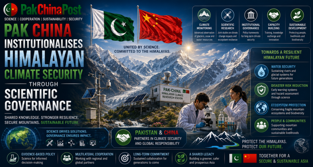
Pak China Institutionalises Himalayan Climate Security Through Scientific Governance

Pak China cooperation is entering an era where environmental intelligence is becoming inseparable from strategic stability. While traditional security calculations have long concentrated upon territorial defence, economic connectivity and technological competition, accelerating cryospheric transformation across the Himalayas is steadily redefining national security priorities. Melting glaciers, expanding glacial lakes, unpredictable hydrological behaviour and fragile mountain ecosystems are no longer confined to environmental policy. They now influence infrastructure resilience, agricultural productivity, hydroelectric planning, population displacement, military logistics and regional diplomatic confidence. The Himalayan watershed has consequently evolved into a strategic geography where scientific capability increasingly determines national preparedness. For Islamabad and Beijing, the challenge extends beyond responding to natural disasters. The greater imperative lies in institutionalising scientific security before climate volatility evolves into a persistent source of geopolitical instability.
The Himalayan region contains one of the world’s largest concentrations of freshwater outside the polar regions. Its glaciers sustain the headwaters feeding major Asian river systems that support billions of people. Yet recent observations demonstrate accelerating glacier retreat accompanied by increasingly irregular snowfall, changing precipitation cycles and widespread permafrost degradation. The consequences are not linear. Initially, enhanced glacier melt temporarily increases river discharge, creating an illusion of water abundance. Subsequently, shrinking ice reserves reduce long term river flows, threatening irrigation, urban consumption, hydropower generation and ecological sustainability. This hydrological transition represents one of the most underestimated strategic risks confronting South and Central Asia.
Pakistan occupies a uniquely vulnerable position within this evolving landscape. The Indus Basin remains overwhelmingly dependent upon glacier and snowmelt originating from northern mountain systems. Agriculture, electricity generation and food security collectively rely upon predictable seasonal water availability. Climatic disruption increasingly weakens this predictability. River behaviour exhibits greater variability, while prolonged droughts alternate with catastrophic flooding. Water management institutions designed around historical climatic assumptions struggle to accommodate unprecedented fluctuations. Consequently, climate uncertainty gradually transforms into fiscal uncertainty, developmental uncertainty and national security uncertainty.
China confronts comparable vulnerabilities across the Tibetan Plateau, where extensive glacier systems sustain multiple transboundary river networks. The country’s western provinces increasingly experience altered runoff patterns, ecological degradation and heightened disaster exposure. Beijing has therefore invested heavily in cryosphere science, remote sensing technologies, satellite observation networks and climate modelling capabilities. These scientific investments demonstrate recognition that environmental intelligence now constitutes a strategic national asset comparable to conventional surveillance or economic forecasting. Nevertheless, unilateral monitoring cannot adequately address interconnected mountain ecosystems whose hydrological processes transcend administrative boundaries.
Scientific fragmentation represents one of the principal institutional weaknesses across the Himalayan region. Multiple agencies collect environmental data using incompatible methodologies, differing temporal intervals and inconsistent technical standards. Satellite imagery often remains disconnected from ground observations. Meteorological departments operate separately from geological institutions. Disaster management authorities receive fragmented information rather than integrated risk assessments. Consequently, early warning frequently arrives too late to prevent infrastructure destruction or civilian casualties. Environmental governance therefore suffers less from scientific scarcity than from institutional compartmentalisation.
Glacial Lake Outburst Floods illustrate this governance dilemma with particular clarity. Rising temperatures accelerate glacier retreat, creating unstable lakes restrained by fragile moraine formations. These natural dams remain vulnerable to heavy rainfall, avalanches, seismic activity or progressive erosion. Once breached, enormous water volumes descend mountain valleys with extraordinary velocity, destroying settlements, roads, bridges, communication systems and hydroelectric facilities. Traditional flood forecasting mechanisms provide limited protection because Glacial Lake Outburst Floods evolve rapidly within inaccessible terrain. Effective mitigation requires continuous satellite observation integrated with artificial intelligence assisted predictive modelling, automated sensor networks and rapid institutional coordination.
Pakistan has experienced repeated episodes demonstrating the destructive capacity of mountain hazards. Northern communities increasingly encounter flash floods, landslides and infrastructure failures linked to changing cryospheric dynamics. Transport corridors connecting remote districts frequently remain interrupted for extended periods. Strategic highways supporting regional commerce encounter growing maintenance costs as unstable slopes accelerate erosion. Hydroelectric facilities face sediment accumulation, unpredictable inflows and heightened engineering pressures. Insurance mechanisms remain underdeveloped, leaving reconstruction overwhelmingly dependent upon public expenditure.
China’s western transport infrastructure similarly confronts environmental stress. Railways, highways, pipelines and energy transmission corridors crossing mountainous terrain increasingly require climate adaptive engineering. Permafrost degradation destabilises foundations. Intense precipitation increases landslide frequency. Glacier retreat alters sediment transport affecting reservoirs and water management systems. Infrastructure originally designed under twentieth century climatic assumptions increasingly encounters twenty first century environmental realities. Consequently, engineering resilience now depends upon continuously updated environmental intelligence rather than static historical datasets.
These shared vulnerabilities create opportunities for institutional rather than merely diplomatic cooperation. Existing bilateral mechanisms predominantly concentrate upon economic development, infrastructure financing and commercial connectivity. Climate science remains comparatively peripheral despite its growing strategic significance. Establishing permanent scientific governance architecture would substantially strengthen long term bilateral resilience. Rather than treating environmental cooperation as an auxiliary confidence building measure, Islamabad and Beijing could integrate climate intelligence directly into strategic planning frameworks governing infrastructure, investment and disaster preparedness.
Satellite cooperation constitutes perhaps the most immediate area for expansion. China possesses sophisticated earth observation capabilities capable of monitoring glacier movement, snow cover variation, lake expansion and terrain deformation with increasing temporal resolution. Pakistan possesses expanding remote sensing institutions alongside extensive field access across vulnerable mountain regions. Combining satellite surveillance with locally validated observations would substantially improve model accuracy while reducing uncertainties associated with isolated datasets. Continuous data assimilation would permit near real time environmental situational awareness extending across shared mountain systems.
Artificial intelligence offers additional opportunities to transform raw environmental information into operational decision support. Machine learning algorithms increasingly detect subtle changes within glacier morphology, snow accumulation patterns and hydrological behaviour before visible deterioration becomes apparent. Integrating satellite imagery, meteorological observations, river discharge measurements and geological indicators enables predictive systems capable of identifying elevated hazard probabilities weeks or months before catastrophic events occur. Such forecasting capability shifts disaster governance from emergency response towards anticipatory resilience.
Predictive climate modelling likewise requires substantial institutional enhancement. Existing regional models frequently struggle to represent complex mountain microclimates characterised by steep elevation gradients, highly variable precipitation and rapidly changing atmospheric circulation. Bilateral supercomputing collaboration, shared climate datasets and coordinated model validation would substantially improve forecasting precision. More accurate projections would directly support reservoir management, irrigation scheduling, hydroelectric optimisation and infrastructure investment decisions extending decades into the future.
Scientific cooperation should equally encompass biodiversity monitoring and ecosystem restoration. Mountain forests regulate watershed stability through soil retention, moisture regulation and ecological resilience. Deforestation accelerates erosion while amplifying flood intensity. Alpine wetlands increasingly experience degradation reducing natural water storage capacity. Joint ecological monitoring programmes integrating satellite observation with biological field surveys would generate comprehensive understanding of environmental interactions influencing hydrological stability. Conservation therefore becomes not merely an environmental objective but a strategic investment supporting long term water security.
Environmental diplomacy increasingly rewards countries demonstrating scientific transparency rather than political rhetoric. Climate negotiations increasingly emphasise measurable adaptation outcomes supported by verifiable evidence. Joint Pakistan China scientific publications, integrated glacier inventories and cooperative environmental assessments would enhance international credibility while strengthening negotiating positions within global climate governance forums. Scientific partnerships frequently generate diplomatic trust exceeding that achievable through conventional political declarations because empirical collaboration creates enduring professional networks resistant to geopolitical fluctuations.
National disaster management institutions likewise require structural adaptation. Existing emergency frameworks often activate after disasters have already commenced. Contemporary climate risks demand continuously operating analytical centres capable of integrating environmental monitoring, predictive analytics and operational planning. Pakistan’s disaster governance architecture would benefit from establishing specialised mountain risk assessment units staffed by climatologists, hydrologists, glaciologists, engineers, military planners and geospatial analysts working within unified operational platforms. Similar institutional integration already informs advanced disaster management systems internationally.
Civil military cooperation assumes particular significance within mountainous regions where logistical access frequently depends upon defence capabilities. Military engineering formations, aviation assets and communication infrastructure routinely support disaster response across inaccessible terrain. Integrating scientific early warning directly into military operational planning would improve mobilisation timelines while reducing humanitarian losses. Environmental intelligence therefore becomes an enabling capability supporting both civilian protection and national preparedness without altering traditional defence responsibilities.
Hydropower planning similarly requires strategic recalibration. Historically, infrastructure design relied heavily upon historical hydrological averages. Accelerating climatic variability increasingly invalidates those assumptions. Reservoir operating rules, dam safety protocols and sediment management strategies require dynamic adjustment reflecting evolving environmental conditions rather than historical experience alone. Bilateral engineering cooperation could generate adaptive design standards applicable across mountain infrastructure confronting comparable climatic pressures.
Water diplomacy represents another emerging strategic dimension. Future regional stability will increasingly depend upon transparent hydrological information sharing. Scientific uncertainty frequently generates political suspicion. Conversely, jointly validated environmental data reduces misunderstanding while facilitating cooperative resource management. Establishing bilateral hydrological information exchanges governed by agreed technical protocols would enhance confidence without compromising sovereign interests. Such arrangements would strengthen practical cooperation while avoiding politically sensitive debates surrounding water allocation.
Academic institutions should become central participants within this evolving architecture. Universities frequently generate valuable environmental research that remains disconnected from policy implementation. Establishing Pakistan China Himalayan Research Consortiums integrating universities, meteorological agencies, geological surveys, defence research institutions and disaster authorities would accelerate knowledge translation into operational decision making. Joint doctoral programmes, scientific exchanges and collaborative field expeditions would cultivate specialised expertise sustaining cooperation beyond individual political cycles.
Financial governance also requires adaptation. Climate resilience increasingly influences sovereign investment attractiveness. Infrastructure financiers evaluate environmental risk alongside economic viability. Developing bilateral climate risk financing mechanisms supporting resilient infrastructure, ecological restoration and scientific monitoring would reduce long term fiscal exposure while attracting international co financing aligned with sustainable development objectives. Environmental investment should therefore be viewed as preventative national security expenditure rather than discretionary ecological spending.
Digital technologies further expand opportunities for integrated environmental governance. Internet of Things sensor networks deployed across vulnerable watersheds could continuously monitor lake levels, ground movement, precipitation intensity and river discharge. Satellite communications ensure uninterrupted data transmission from remote locations. Cloud based analytical platforms permit simultaneous access by multiple institutions. Blockchain verification may strengthen environmental data integrity supporting both scientific credibility and operational confidence. Digital environmental governance therefore complements traditional observational science through enhanced speed, transparency and analytical precision.
Public communication strategies require corresponding improvement. Early warning systems remain ineffective when communities neither understand nor trust official alerts. Risk communication should therefore integrate scientific accuracy with locally accessible messaging delivered through multilingual platforms. Community participation in environmental monitoring similarly strengthens resilience by incorporating indigenous knowledge regarding seasonal variations, landscape changes and historical hazard patterns often overlooked within purely technical assessments.
International experience demonstrates that successful mountain governance depends upon institutional continuity rather than episodic project implementation. Numerous climate initiatives deteriorate following donor withdrawal because permanent administrative structures remain absent. Pakistan and China should therefore establish standing bilateral institutions supported through predictable governmental financing, legally defined mandates and regular technical exchanges. Institutional permanence would ensure sustained capability development irrespective of political transitions or budgetary fluctuations.
The strategic value of scientific sovereignty deserves particular attention. Environmental dependence upon externally generated data may constrain autonomous decision making during periods of geopolitical tension. Strengthening indigenous observation capability while expanding trusted bilateral cooperation enhances analytical independence. Scientific capacity consequently becomes an element of comprehensive national resilience supporting informed policy across agriculture, infrastructure, defence, public health and environmental governance.
Establishment planners increasingly recognise that future security threats will emerge from interconnected systemic pressures rather than isolated events. Glacier instability influences food production, migration patterns, infrastructure durability, fiscal sustainability, humanitarian response and diplomatic engagement simultaneously. Conventional bureaucratic divisions separating environmental policy from national security therefore appear increasingly outdated. Strategic planning requires integrated analytical frameworks recognising climate intelligence as foundational infrastructure supporting governmental decision making.
Pak China cooperation possesses an opportunity to redefine Himalayan governance through institutional innovation rather than reactive crisis management. A permanent Himalayan Scientific Security Commission reporting directly to senior national leadership could coordinate satellite surveillance, predictive climate modelling, glaciological research, hydrological intelligence, environmental diplomacy and disaster preparedness within a unified strategic framework. Complementing this institution with a Joint Cryosphere Intelligence Centre, integrated climate data architecture, interoperable early warning systems, climate resilient infrastructure standards, coordinated military humanitarian planning, specialised mountain research academies and shared environmental financing mechanisms would transform bilateral cooperation from episodic scientific collaboration into enduring strategic governance. Such an architecture would not merely strengthen disaster preparedness. It would establish scientific capability as a core instrument of national resilience, ensuring that environmental intelligence becomes an enduring pillar of Pakistan China strategic partnership throughout an era defined increasingly by climatic uncertainty rather than conventional geopolitical competition.
A Public Service Message